


Marble Hill - Manhattan
The Manhattan Neighborhood That's Actually In The Bronx


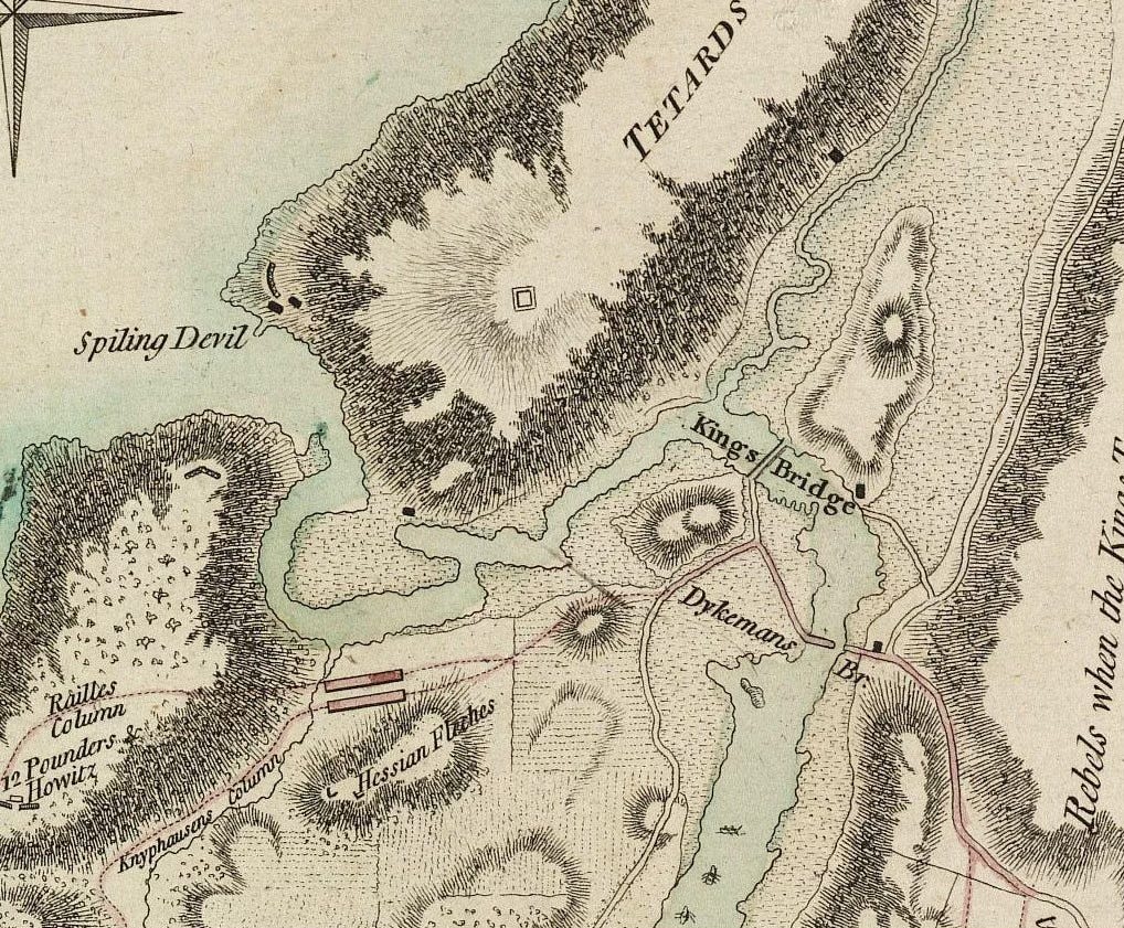
Marble Hill is Manhattan’s northernmost neighborhood—so far north, in fact, that it’s no longer physically connected to the rest of the borough. Though politically tied to Manhattan, Marble Hill is geographically part of the Bronx. But it wasn’t always so.
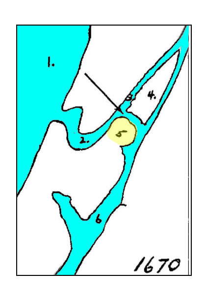
Until the late 19th century, Marble Hill sat at the northern tip of Manhattan Island, separated from the mainland by the swirling waters of Spuyten Duyvil Creek. A modest 88-foot span, known as the King’s Bridge, linked it to the mainland in what is today considered the Bronx—a crossing the New York Times once called “the first impulse of the early city toward expansion.”
In the late 1800s, efforts to create a more navigable connection between the Hudson and Harlem Rivers led to the construction of the Harlem River Ship Canal. The project effectively severed Marble Hill from the rest of Manhattan. Then, in 1913, the remainder of Spuyten Duyvil Creek was filled in, permanently fusing the former chunk of Manhattan to the Bronx.
This geographic sleight of hand has sparked more than a century of confusion, marked by hostile incursions, attempted takeovers, and lingering debates over Marble Hill’s true identity.

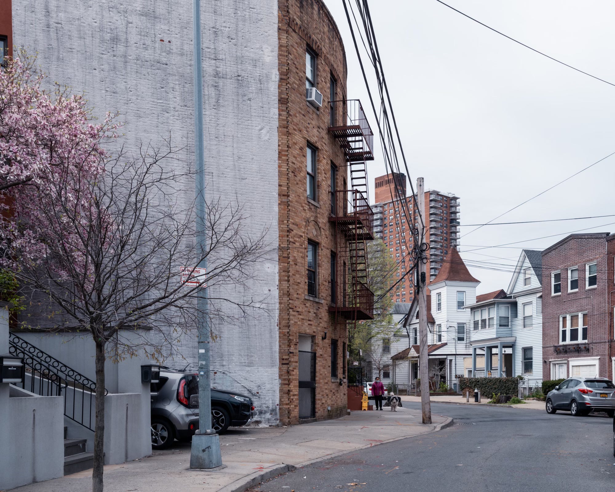
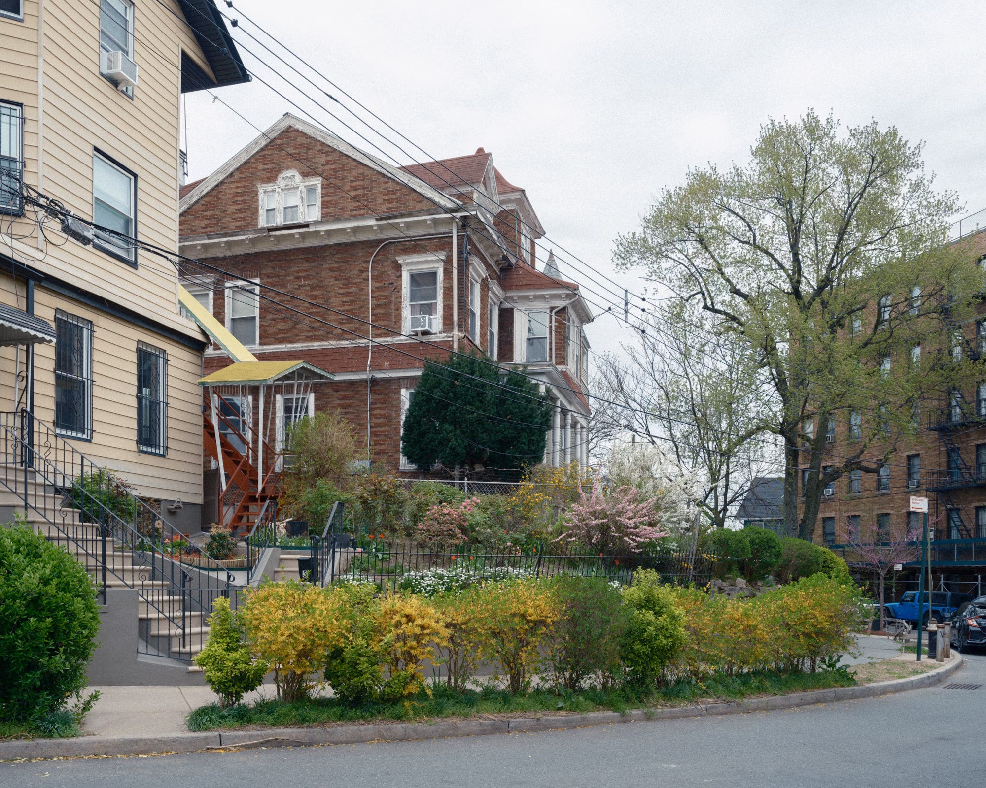
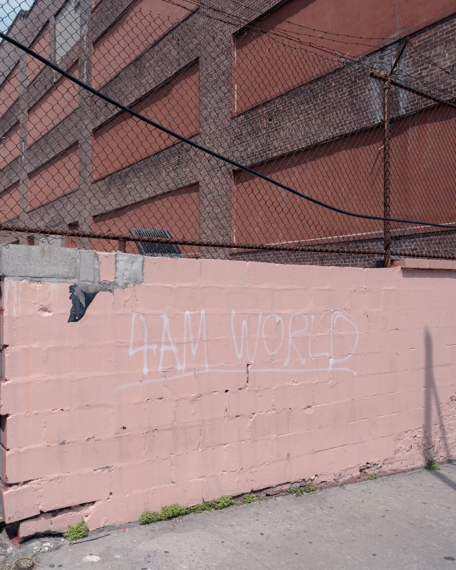
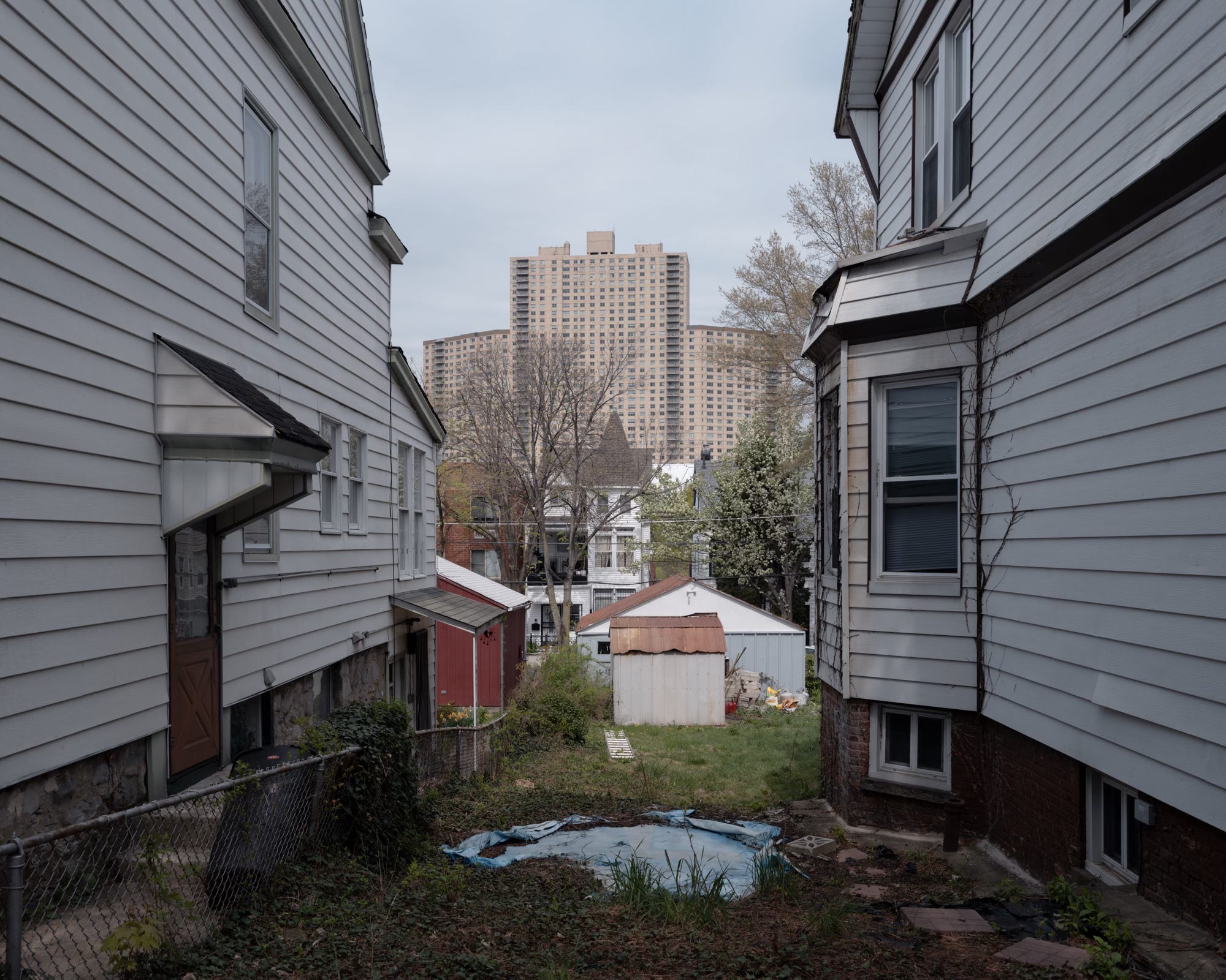
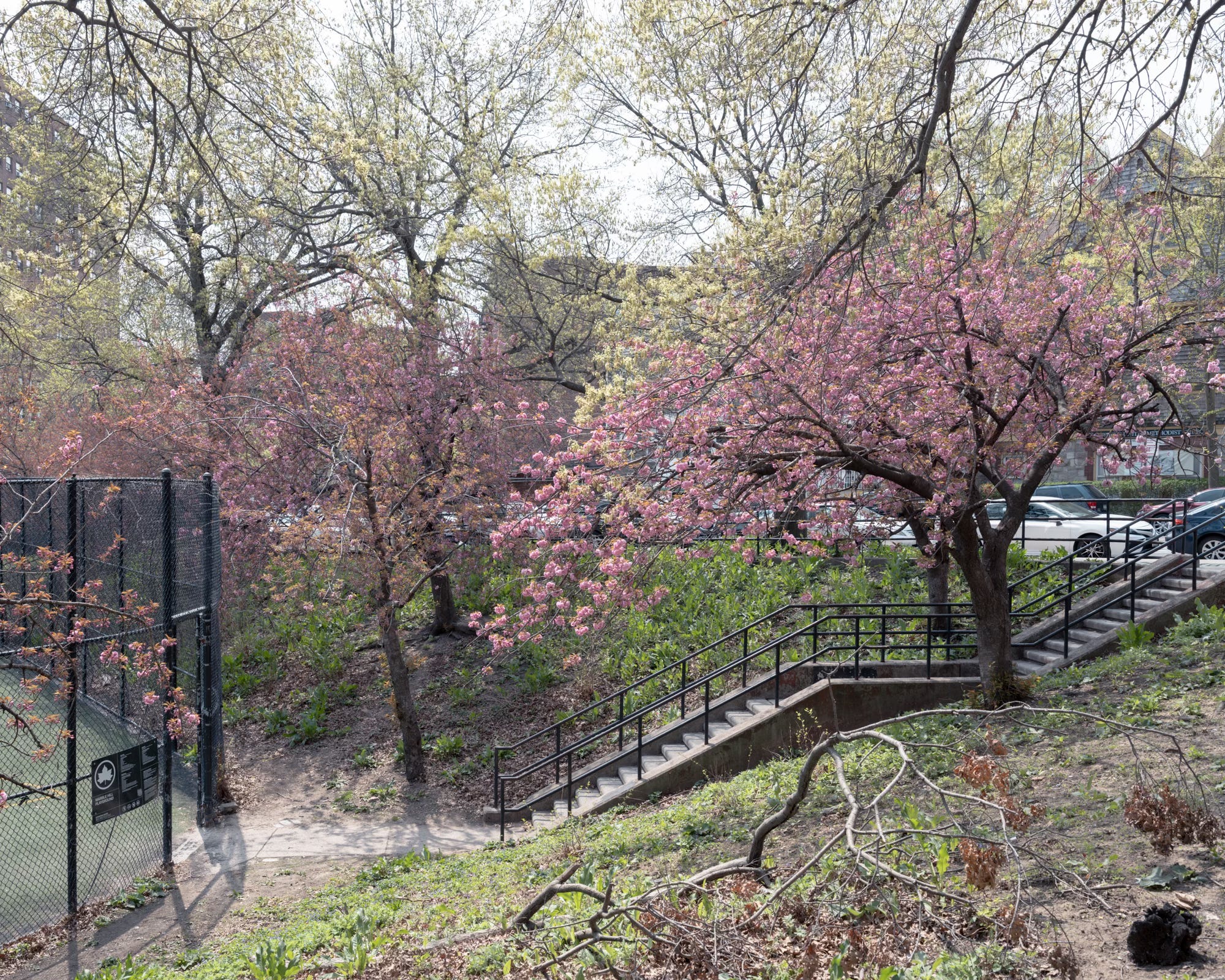
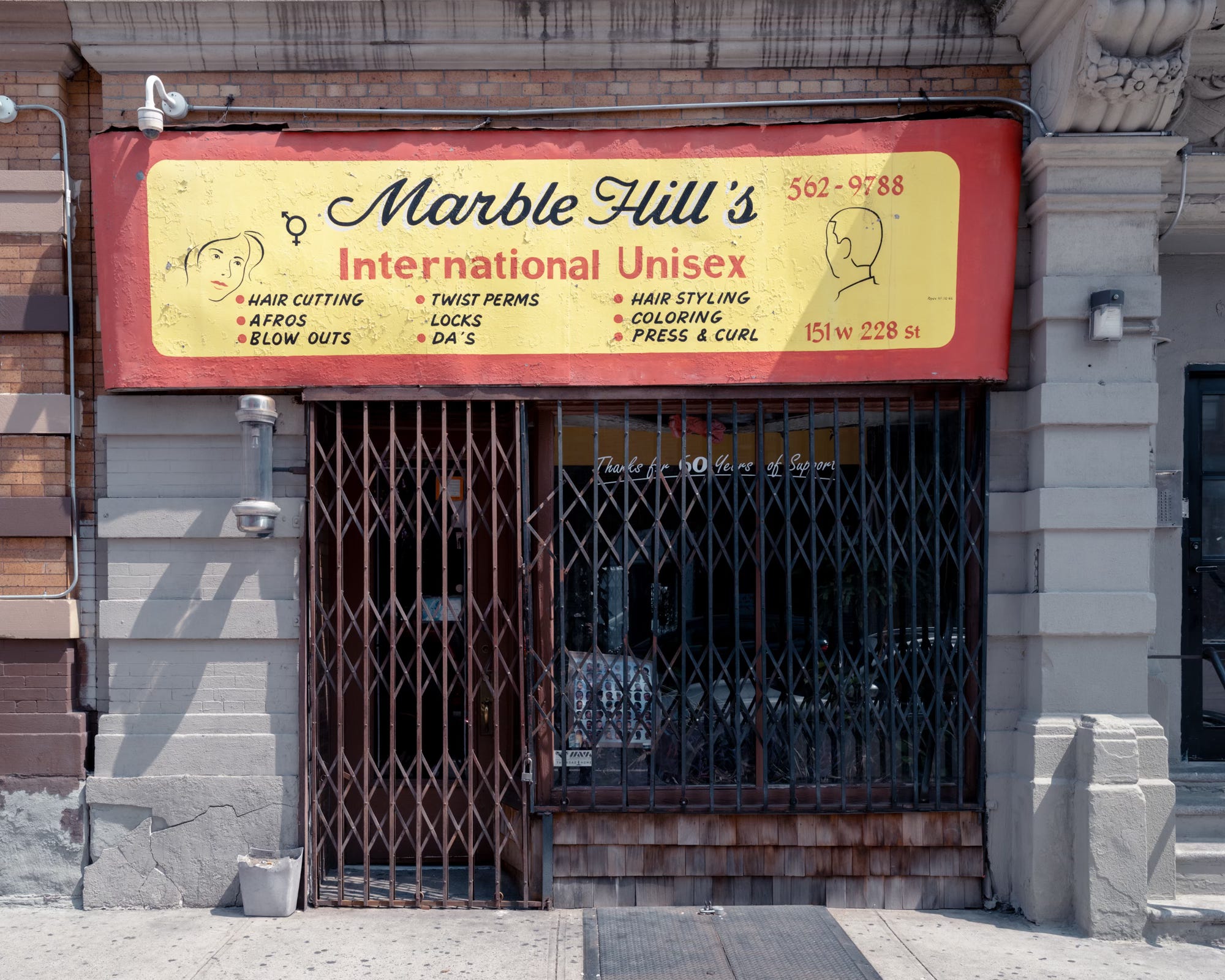
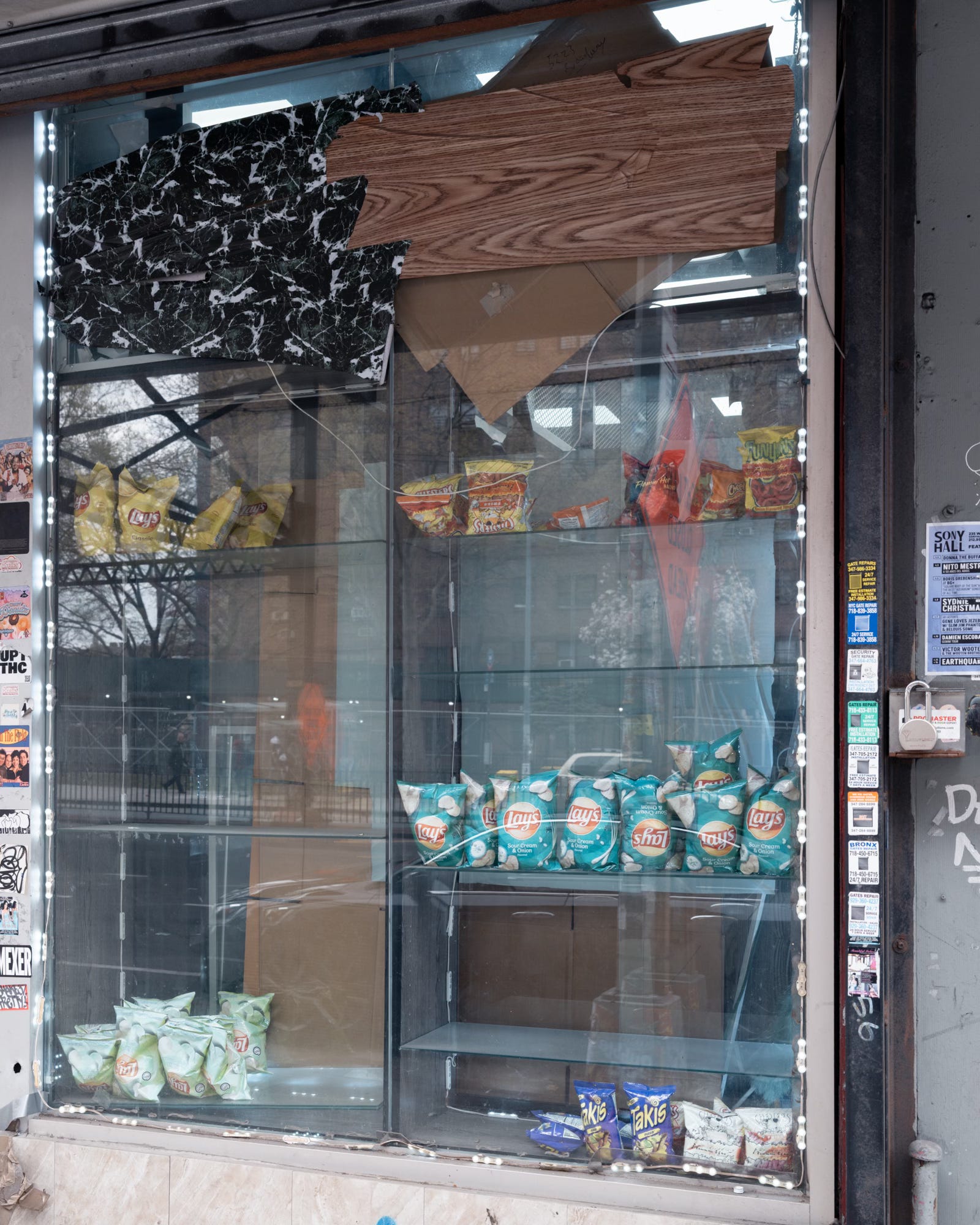
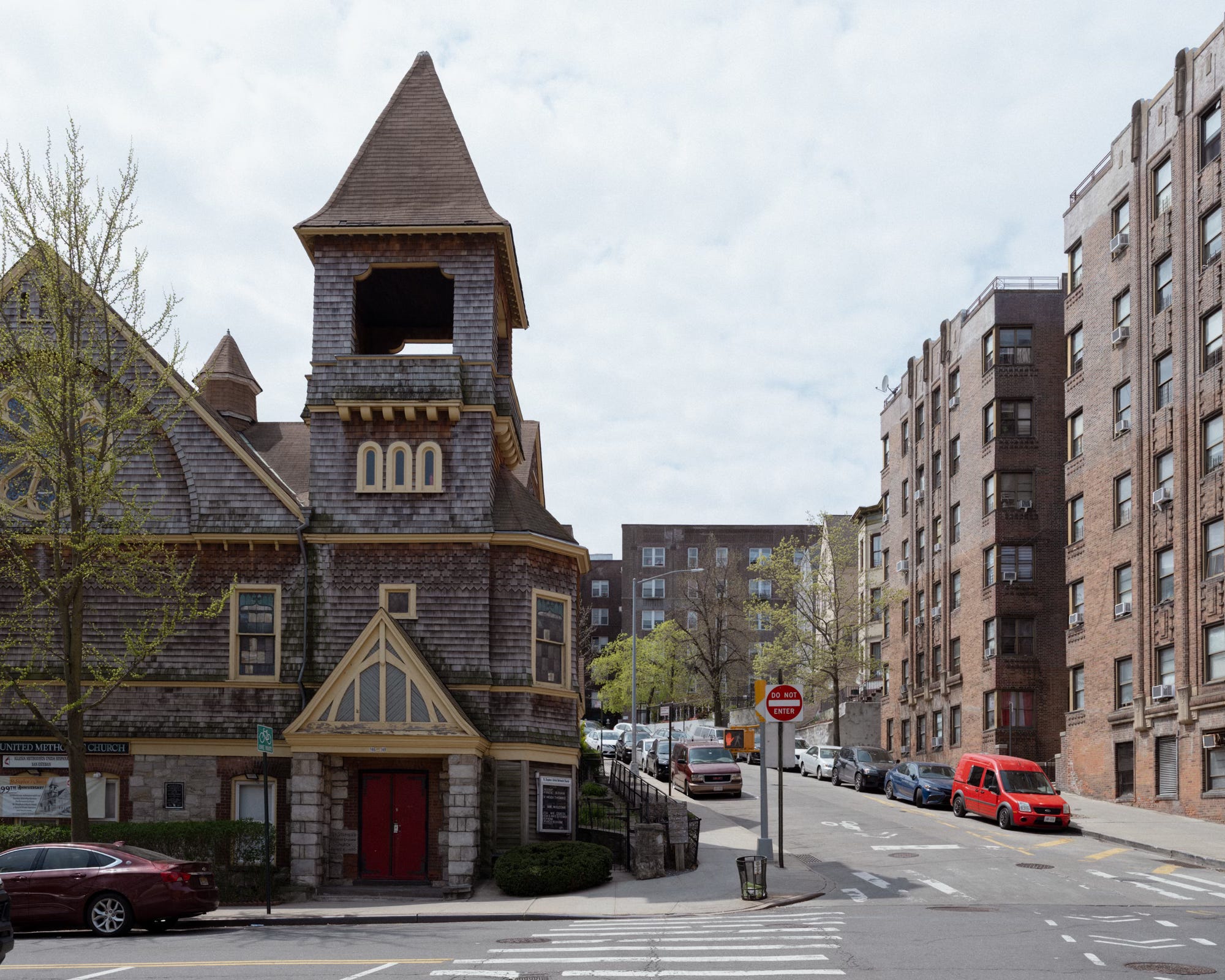
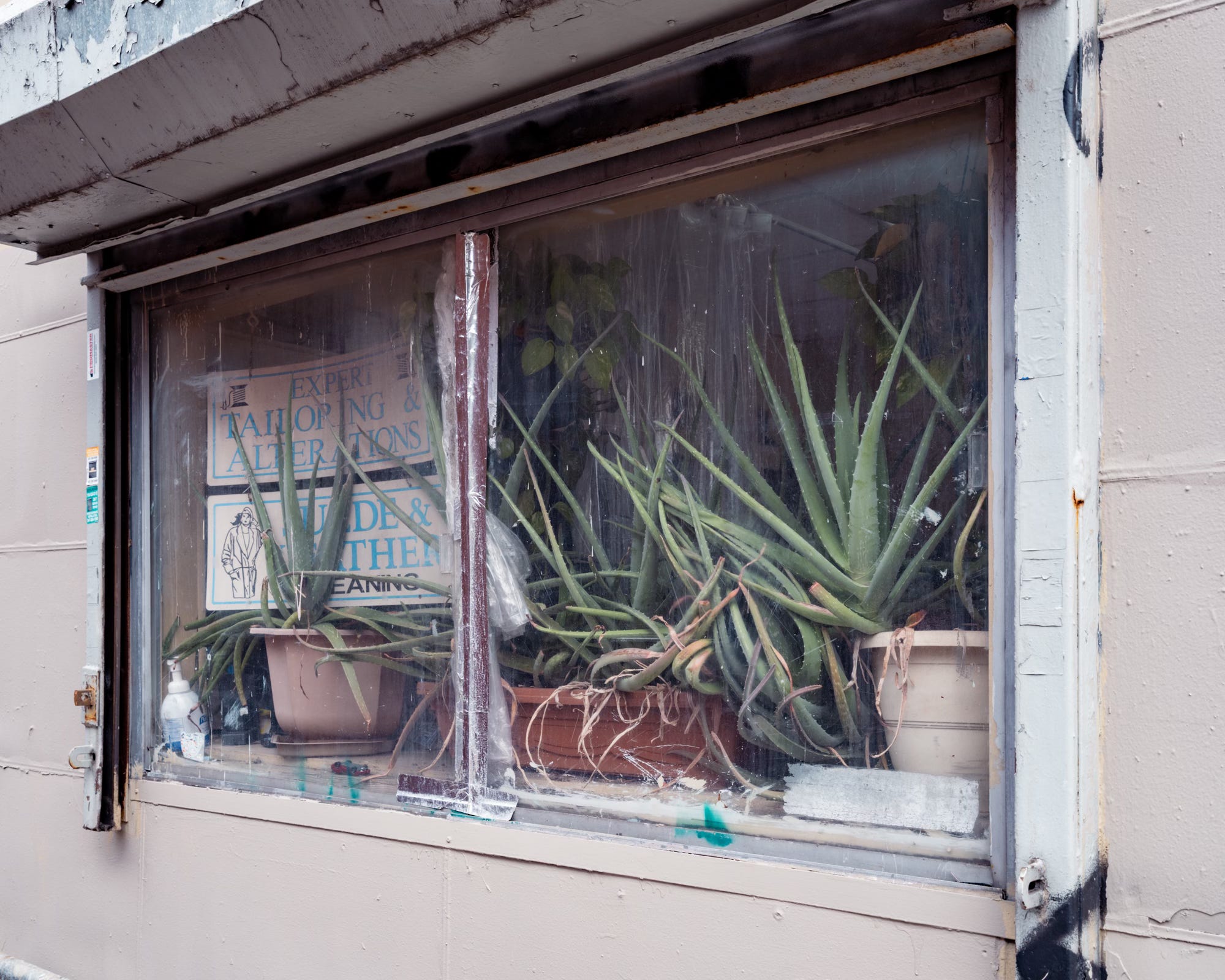
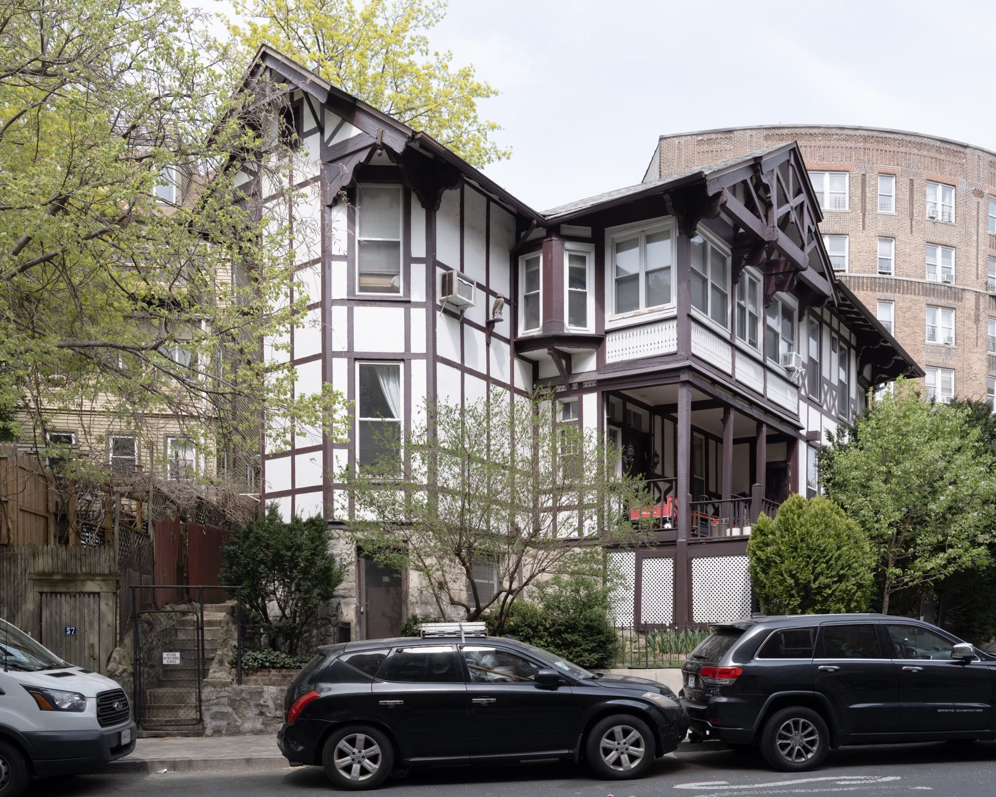
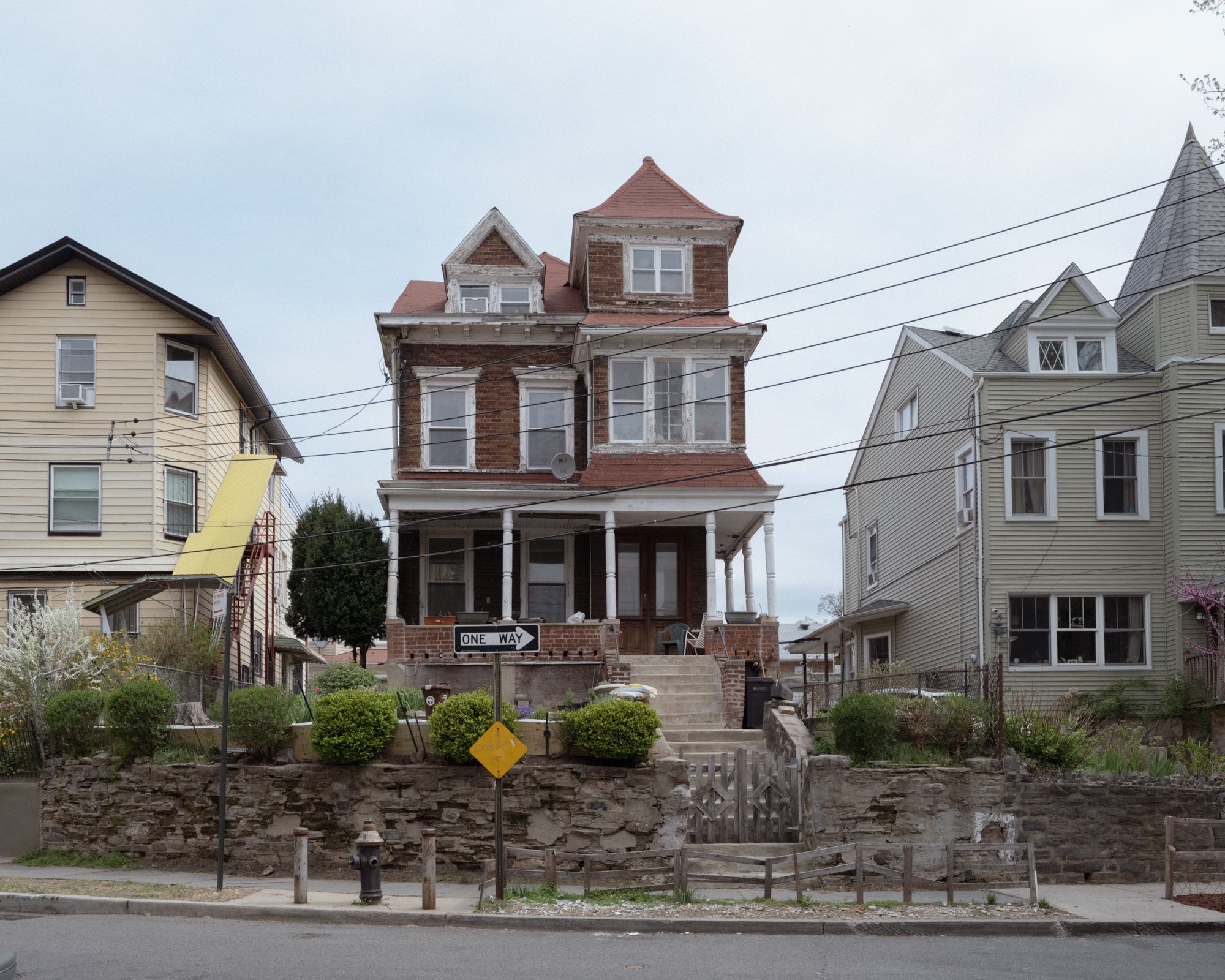
At the heart of the small neighborhood lies a series of quasi-concentric streets, lined with some of Manhattan’s only Victorian houses—complete with porches, turrets, and gables—that spiral up the incline to Marble Hill’s highest point. Several small apartment buildings, their curved facades conforming to the undulating streets, are scattered throughout.
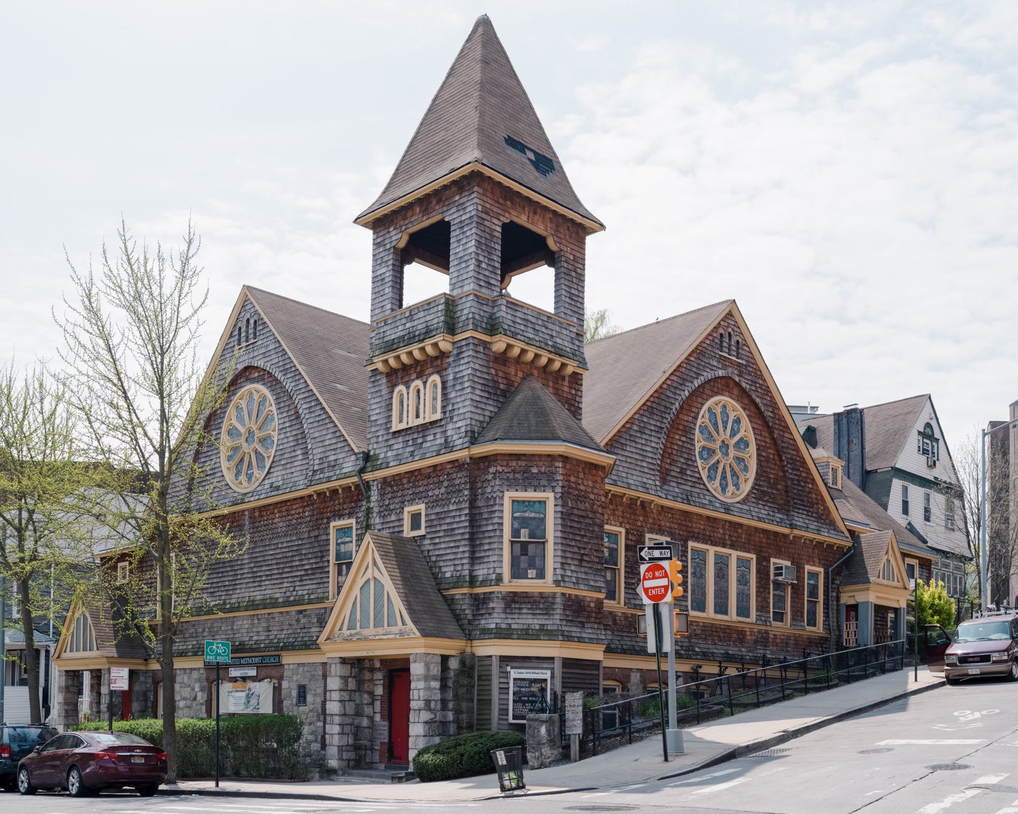
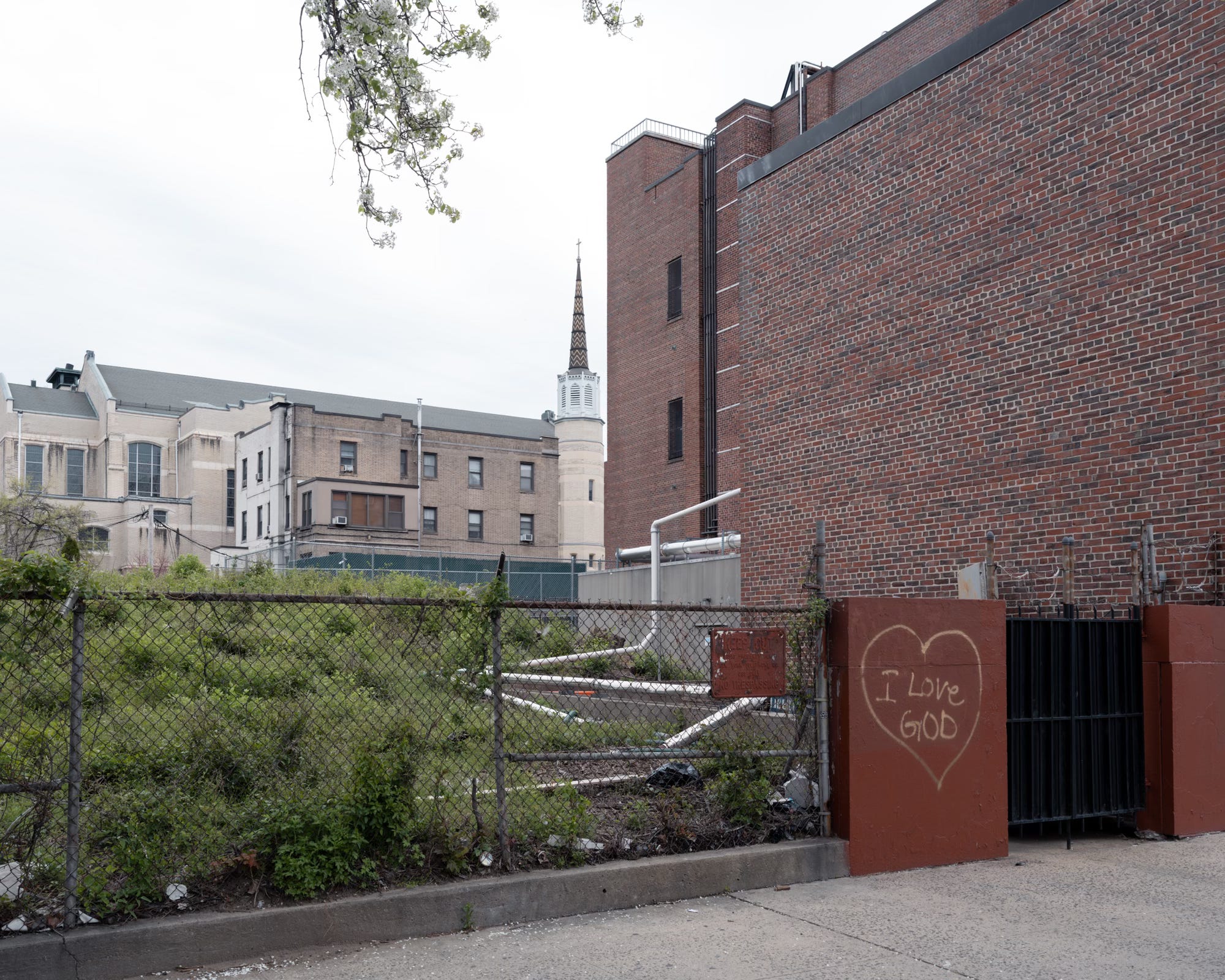
St. Stephen’s United Methodist Church, built in 1897, is at the base of the hill.
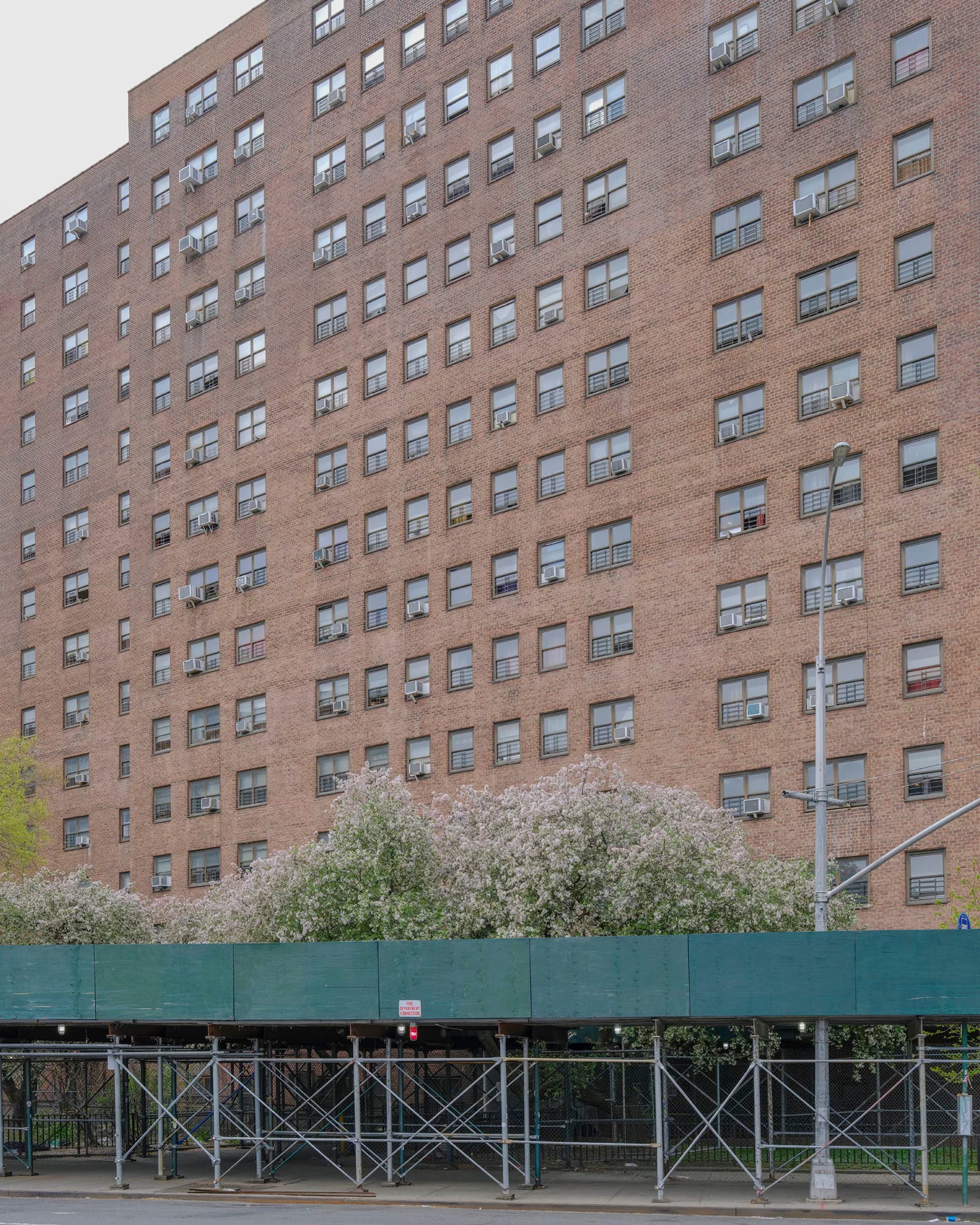
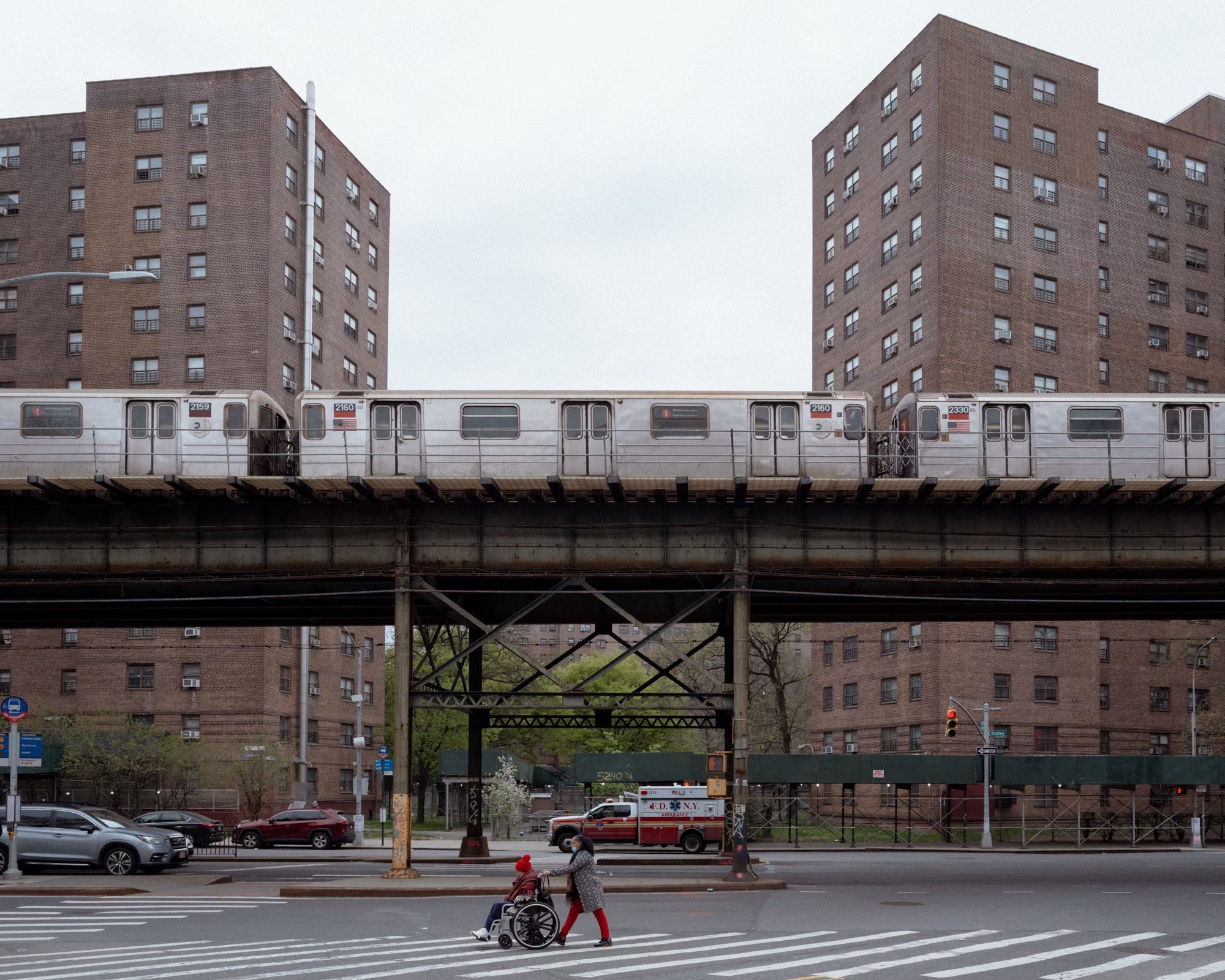
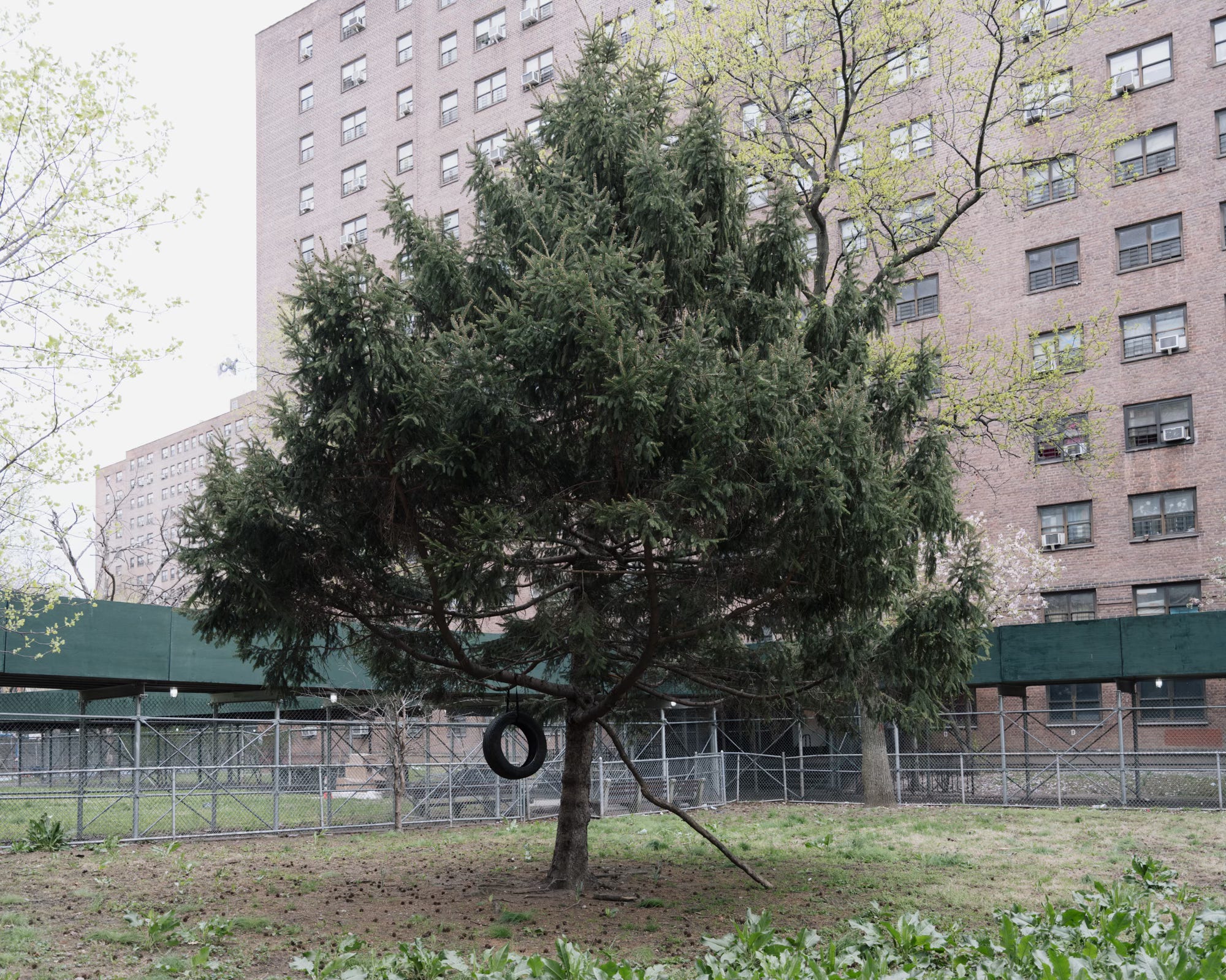
At the southeastern edge of the neighborhood are the Marble Hill Houses, a public housing complex built in 1952, and now home to the majority of the area’s residents. Four of the complex’s eleven towers fall in the Bronx.
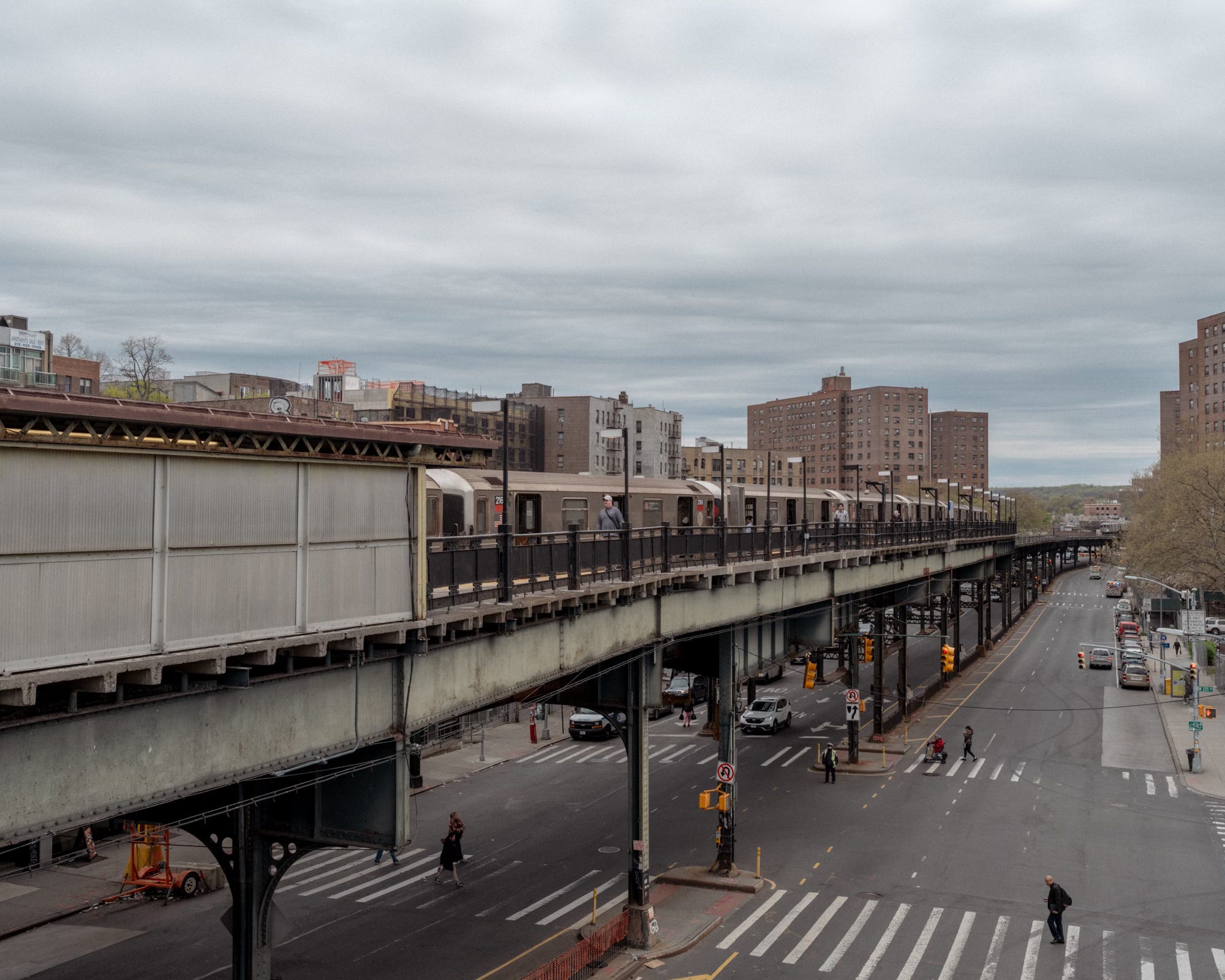
On the neighborhood’s western edge, the eight-story John F. Kennedy High School building—now home to several smaller schools—similarly straddles the invisible Manhattan–Bronx dividing line.
The Wading Place
In the 17th century, there were only two ways to cross the Harlem River: swim or pay for a ride on Johannes Verveelen’s ferry, which departed from the east end of 125th Street. Many travelers opted for the first option. A shallow stretch of the Spuyten Duyvil Creek, just off the northern tip of Manhattan, had long been used by Native Americans as a natural crossing point. They called it the “wading place.”
Verveelen fenced off the area, but travelers simply tore down the barriers. Frustrated, he relocated his ferry to a new site where he could keep a closer eye on fare dodgers. The new landing was near what’s now the intersection of Broadway and West 231st Street.
As the Albany Post Road and Boston Post Road were completed, the need for a permanent crossing between Manhattan and the mainland became increasingly urgent.
King’s Bridge
Enter Frederick Philipse, a Dutch merchant who settled in Flatbush in 1652. After a rather ugly career trajectory—from selling iron nails to running taverns to outfitting pirates and finally trading enslaved people—Philipse amassed a vast fortune and became one of the wealthiest men in the New York colony. His holdings eventually spanned 92,000 acres, stretching from the Hudson to the Harlem River and from Spuyten Duyvil Creek to the Croton River.
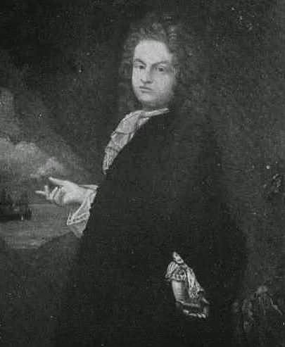
In 1693, after securing a royal charter, Philipse replaced Verveelen’s ferry with what became known as the King’s Bridge, the first bridge to connect Manhattan to the mainland.
Philipse immediately implemented Manhattan’s first congestion pricing scheme. Though the bridge was described as “small, very narrow, and badly built,” Philipse still managed to extract a penny for each head of cattle, two pennies for each person or horse, and 12 pennies for a drove of hogs. Costs doubled at night, and British soldiers got to cross for free.
By 1758, local farmers, tired of ponying up every time they wanted to cross the creek, took matters into their own hands. Led by Jacob Dykeman, they pooled their resources to construct a new span 500 yards away named, appropriately enough, the Free Bridge.
While no toll was collected, Dykeman had the presence of mind to open up a tavern right next to the bridge so that toll evaders could blow the money they saved on the crossing on a calibogus or three.
In 1776, recognizing the strategic importance of the area’s bridges (and taverns), the Continental Army built a fort on top of Marble Hill, which the British promptly captured and renamed Fort Prince Charles.
At the conclusion of the war, the Philipse Manor was seized from the Tory-sympathetic Philipses, and the King’s Bridge, which had been destroyed by retreating Continental soldiers, was rebuilt and opened to all, toll-free. The tavern, which later became the King’s Bridge Hotel, survived until 1917.
SEVERANCE
By the early 19th century, the discovery of valuable Tuckahoe marble deposits in the area spurred the development of several quarries. In 1817, two small streams were widened into a narrow canal to power a marble-cutting mill. This was the opening salvo in the transfiguration of Marble Hill.
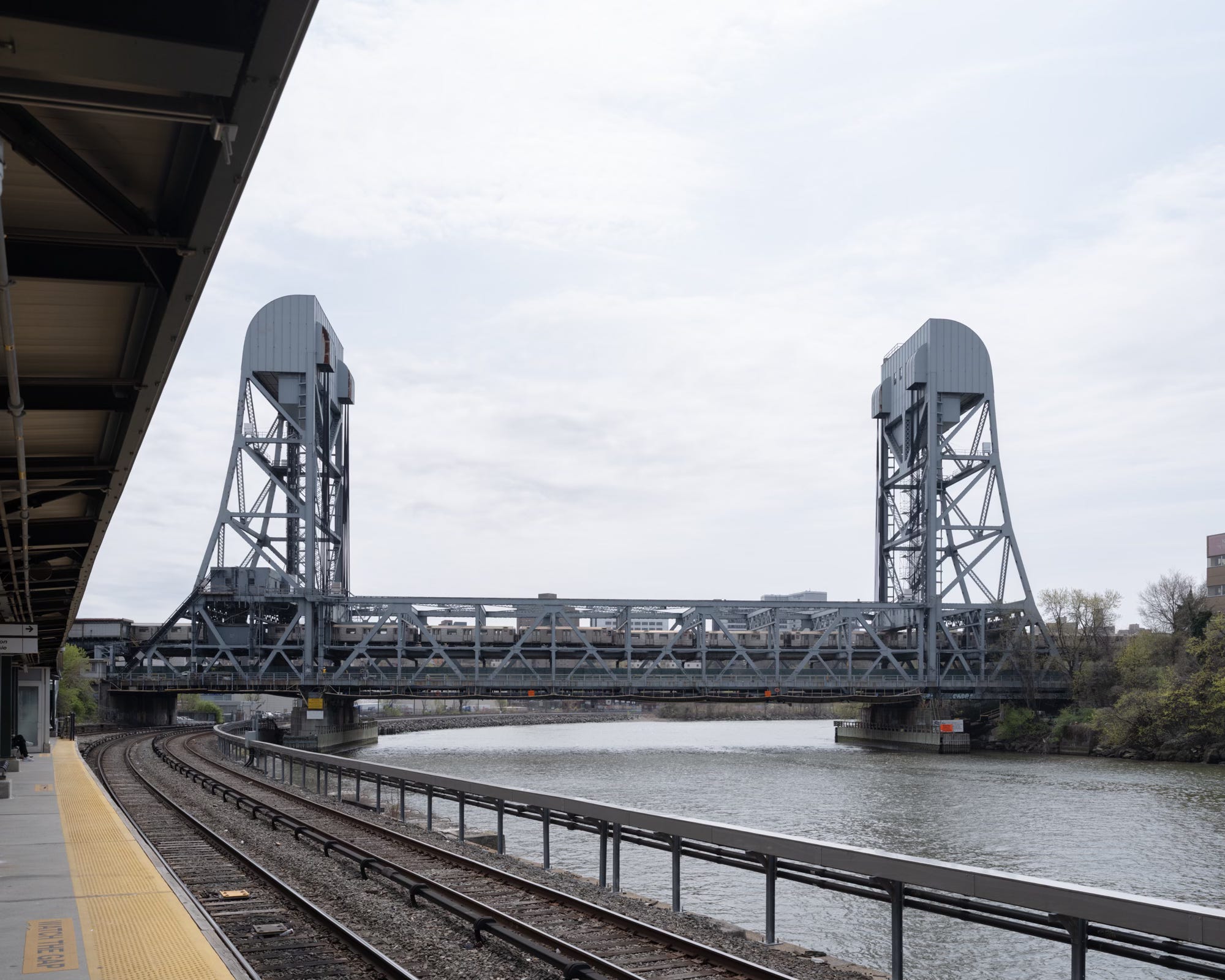
That transformation accelerated in 1876, when the New York State Legislature authorized the construction of the Harlem River Ship Canal. This decision followed the U.S. Army Corps of Engineers’ successful clearing of the Hell Gate channel in the East River, eliminating a notorious hazard to navigation. With the eastern waterways now far safer, attention shifted to creating a more efficient shipping route from the Hudson River along Manhattan’s northern edge.
Work on the canal began in 1888, and soon the Spuyten Duyvil Creek, the once treacherous waterway where Anthony Van Corlear played his last trumpet note, was subsumed by the new, 400-foot-wide passage. In the process, Marble Hill was severed entirely from Manhattan.
Marble Hill remained an island for years until 1913, when rocks removed to build Grand Central Terminal were dumped in what remained of the creek, burying the old Kings Bridge and irrevocably joining the former Manhattan landmass to the mainland.
ANSCHLUSS
“I, therefore, strongly urge that steps be taken to lift this Manhattan yoke from the residents of Marble Hill and restore them to the Bronx.”
In 1939, Bronx Borough President James J. Lyons called for the annexation of Marble Hill, arguing that the Harlem River Ship Canal clearly marked the border between Manhattan and the Bronx—and that Marble Hill, by all logic, belonged to the latter. His crusade to “free Marble Hill from its Manhattan bondage” earned him the nickname the Bronx Führer, and newspaper reporters gleefully compared his claims on Marble Hill to Hitler’s recent annexation of the Sudetenland.
Lyons’ proposal, according to an informal neighborhood survey, prompted “a loud and spontaneous chorus of Bronx cheers instead of ‘heils.’” Only two residents expressed support. One was Mrs. J. E. Tierney of 1 Jacobus Place, who said she’d be open to joining the Bronx—if the borough president agreed to build a park for her son. “Anyway,” she added, “my mother-in-law comes from the Bronx and there’s nothing wrong with her.”
The other exception was Max Peps, an electrician, who reasoned, “Isn’t Manhattan supposed to be surrounded by water? If this place became part of the Bronx, the people would be able to choose their representatives faster. Manhattan is controlled by downtown politicians. The Bronx is noted for its universities, and the people of the Bronx have nothing to be ashamed of.”
It was later discovered that Peps wasn’t even a Marble Hill resident—he lived in the undisputedly Bronx neighborhood of Morris Heights.
Opposition came from many corners, including 18-year-old John Carroll of 44 Adrian Avenue, who declared: “I want to live in Manhattan for the glory of it,” and cigar store proprietor, Abraham Rosensweig, who admitted that Marble Hill’s geographical confusion had actually made him money. “A sucker bet me $100 that this was the Bronx because it was on the north side of the canal, and I won the bet. Of course, he didn’t know it was in Manhattan.”
Bronx Borough President Lyons, seemingly unfazed by the Hitler comparisons or widespread local opposition, returned to Marble Hill a few days later. At the corner of 225th Street and Jacobus Place, he stepped out of his chauffeur-driven limo, climbed a rock outcropping, and planted the official flag of the Bronx.
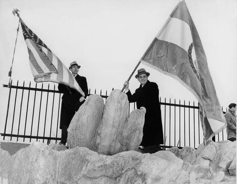
“In the name of The Bronx, of which I am the President,” he declared, “I hereby proclaim this territory of Marble Hill to be part of my borough.”
A few months later, after locals voted overwhelmingly to remain part of Manhattan, a dejected Lyons compared himself to Abraham Lincoln:
Lincoln encountered some slaves who did not want to be liberated, so it is not surprising to find some Marble Hillians who would not want to be freed from excessive taxation and who would resent the injection of the new and finer culture characteristic of the Bronx.
He added, “We have no room in the Bronx for the intolerant or the snob.”
Predictably, the question of which borough Marble Hill belongs to has resurfaced time and again. When the issue came up in the 70s, Rev. Dr. William A. Tieck, then minister of the St Stephen Church and Bronx Borough historian, advocated for secession from Manhattan.
Our orientation is Bronxwise. We have no more rapport with upper Manhattan than with Jersey. Except for garbage collections all our city services—schools, police, mental health clinics—come from the Bronx
It wasn’t until 1984, however, after a Marble Hill resident protested serving on a jury for a murder trial by saying she was not a resident of Manhattan but instead of the Bronx, that the matter was settled for good. The New York State Legislature passed a law definitively declaring Marble Hill part of both Manhattan Borough and New York County.
SIGHTS AND SOUNDS
This week’s audio features the overhead 2 train, the underfoot Metro-North train, and various sounds in and around the neighborhood.
Pro tip: The best place for a picnic in the neighborhood is a bench overlooking the canal at the Metro-North station.

FEATURED PHOTOGRAPHER
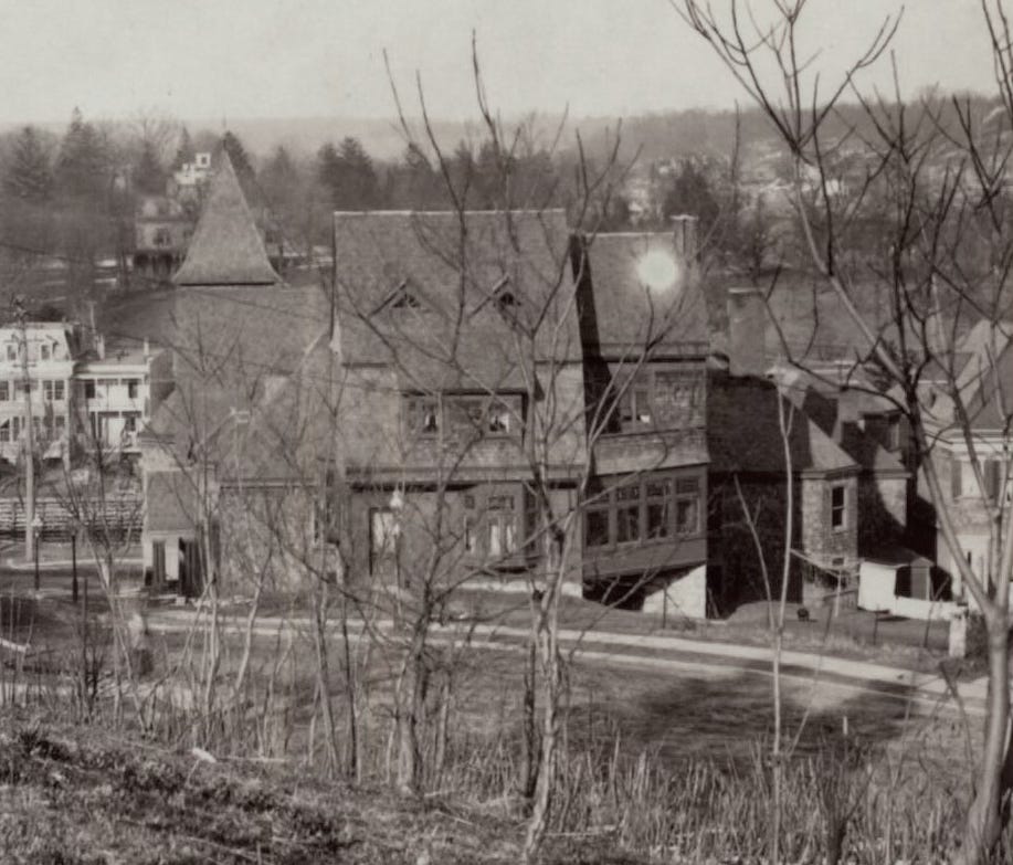
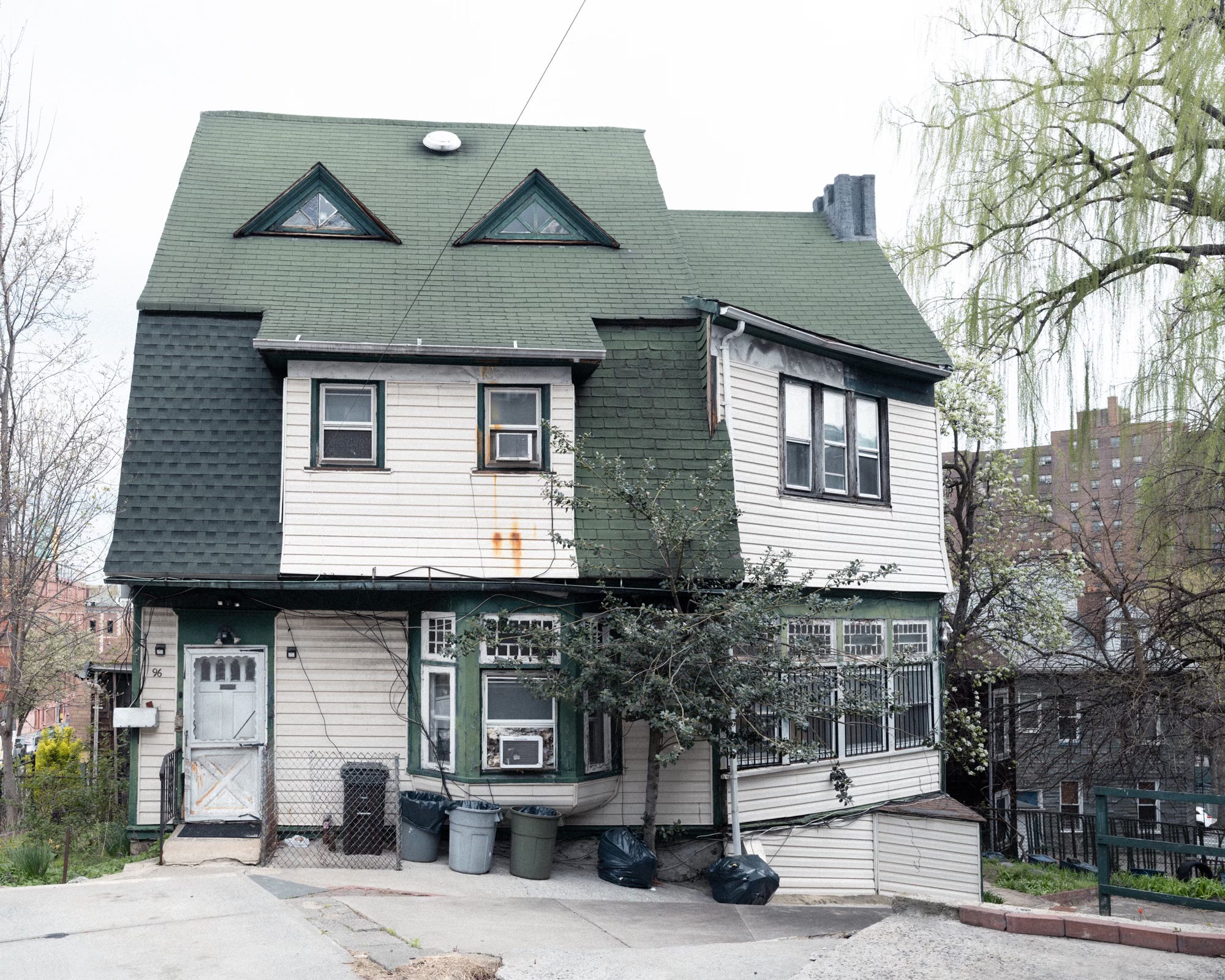
I found these two photographs taken on Marble Hill on the New York Public Library website. They are attributed to the Brown Brothers. The Brown Brothers are considered the world’s oldest stock photo agency, and they have the website to prove it. The company was founded in 1904 by brothers Arthur R. and Charles Brown. While they started out as photographers, they quickly moved on to acquiring old photographs and commissioning other photographers to make new work. I'm not really sure who took these photos, but given their early date (1906), it’s possible one of the brothers was behind the dark cloth.
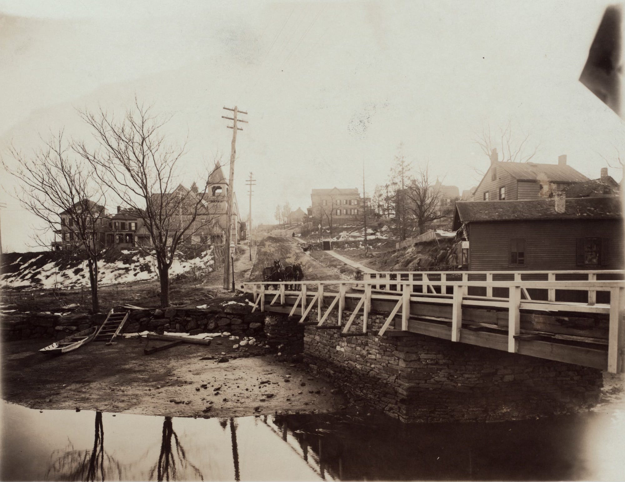
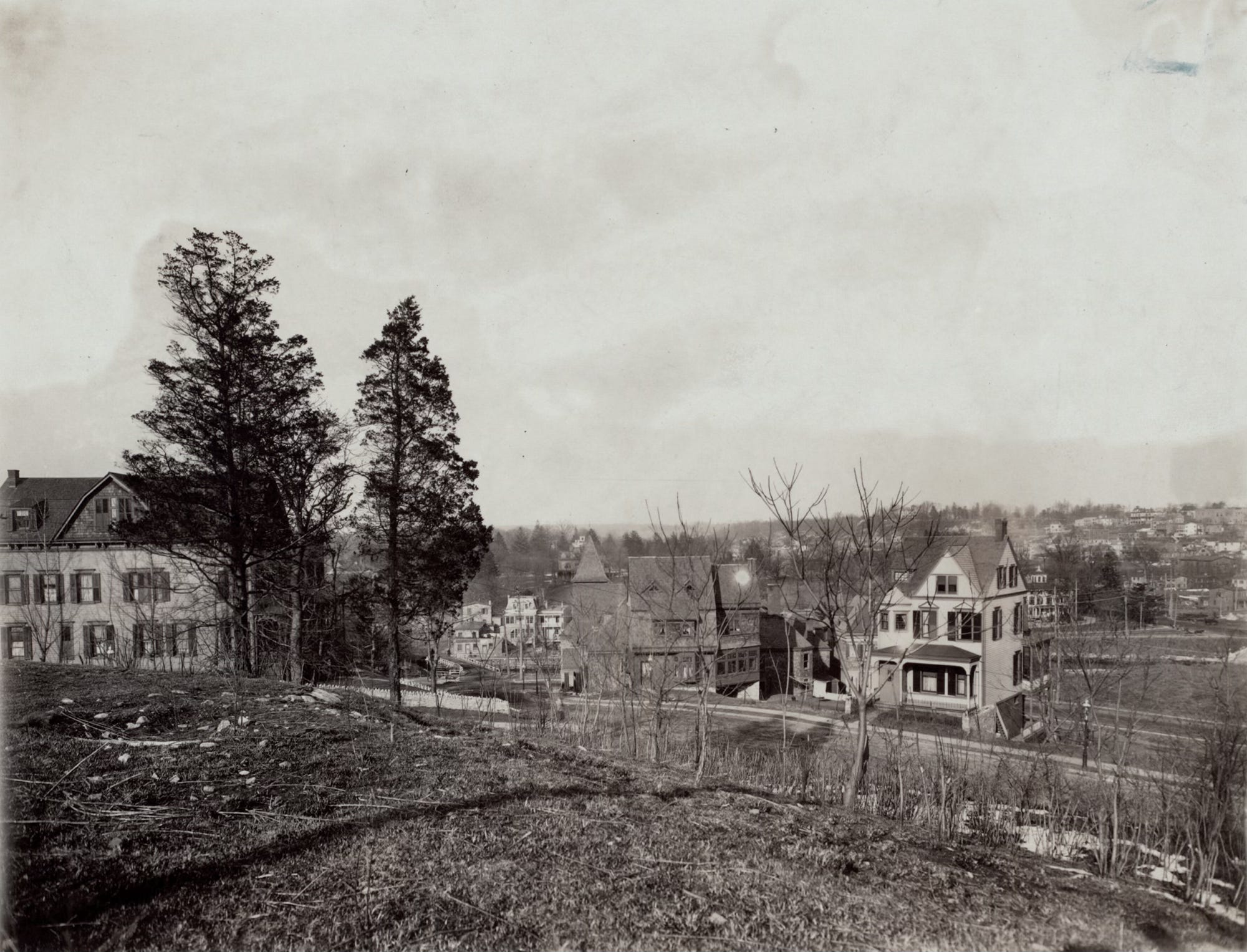
When I zoomed in on the image, I recognized the house at the center by its distinctive triangular dormers. It’s still standing today, now cloaked in multiple layers of siding and asphalt shingles.
ODDS AND END
An 1891 editorial in the New York Times suggested an alternate plan to the building of the Harlem Ship Canal that would have avoided Marble Hill’s subsequent identity crisis. Rather than widening the waterway, the editorial proposed completely filling in Spuyten Duyvil Creek, physically uniting Manhattan with the Bronx.
When Robert Moses built the Henry Hudson Bridge—his era’s equivalent of the historic King’s Bridge—he carved it straight through the last untouched stand of virgin old-growth forest in Inwood Hill Park. A more logical and far less destructive route had already been proposed: one that would bypass the park entirely and avoid the steep bluffs along the Hudson, landing instead in Marble Hill. But Moses realized he could get “free” labor from the federal government if he classified the bridge on ramp as “park access roads,” so he ignored the less invasive route.
Since 2014, the Great and Glorious Grand Army of the Bronx has marched through the streets of Marble Hill every spring and planted the tricolor Bronx flag with its "Ne cede malis" motto atop the same rocky outcropping mounted by former Bronx Borough President Lyon in his failed inter-borough coup in 1939. In the past, the event has taken place in May, so check out their Facebook page if you are interested in joining the revolution.
Just a quick heads-up that I’ll be exhibiting work from The Neighborhoods project at the Future Fair in Chelsea with 3Walls. The opening is May 7th, and the Fair continues from May 8-10. I’ll share more details next week.
This is my favourite series on Substack. Terrific!
I learn so much every week from this newsletter! Thank you!